
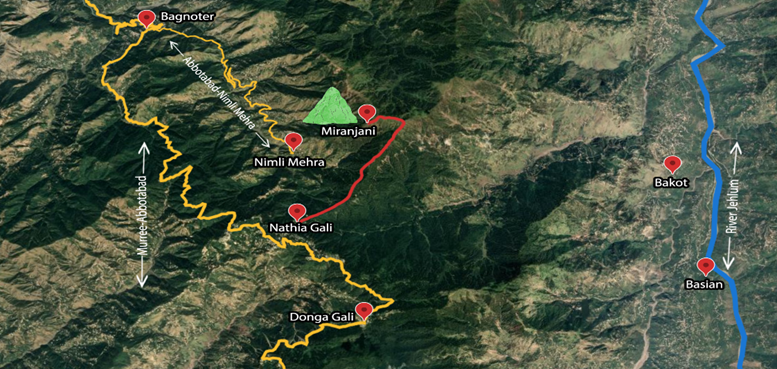
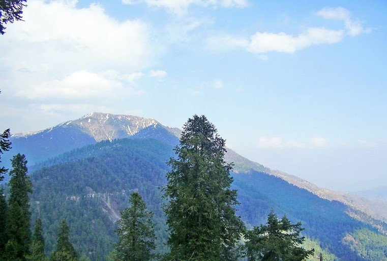
Miranjani is the highest mountain of Galyaat region at 9816 feet or 2992 meters. It is easily approachable from Nathiagali, and from Thandiani, Abbotabad by an overnight trek. The ridgeline leading to the Miranjani Top appears on the Nathiagali skyline like an extended hump. Its hike figures out among the attractions of the popular summer hill resort. During summers one invariably finds number of hikers making their way to its Top. Some go beyond via Dagri Bungla to Thandiani or descend to the road going to Abbottabad from Nimli Mehra. Miranjani is part of the Ayubia National Park and falls within the jurisdiction of Abbottabad district.
Forested approach to Miranjani Top
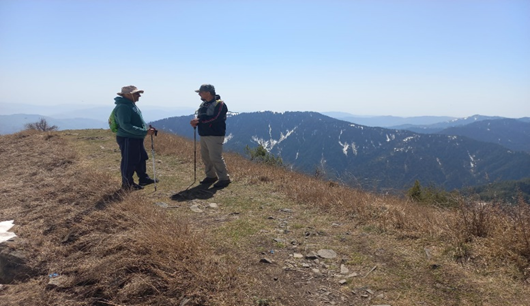
The hike commences close to the Governor House in Nimli Mehra in the outskirts of Nathiagalii. It entails a gradual climb along a grassy and shaded route that goes upto a pond lying roughly mid-way. Then there is an incline through a pine forest and the final ascent goes through a barren stony patch. It takes from one hour and thirty minutes for an experienced hiker, to three hours for novices to reach the Top. The view from the Top is spectacular on a clear day. One can see outskirts of Havelian towards the north. Even Nanga Parbat, lying about 166 kilometers towards northeast with the help of the local guide. Dagri Bungla sits on the adjoining ridge towards east that along River Jhelum, and the scenic Mushkpuri Top sits close by towards southwest. Of course, one gets a great view of the Governor’s House and the adjoining areas of the Nathiagali.
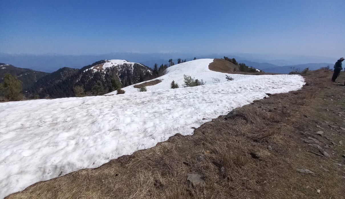
There is no water to be found during the hike during summer with the sharp sun. So, the hiker must take plan for hydration enroute, wear hiking shoes with traction and carry trekking sticks. One should preferably attempt the hike as a group. Lone hikers should hire a local guide. The Hike is best done from May to early October. Winter hikes entail negotiating snow which can be challenging, and they should be attempted with the matching winter gear. We have hiked Miranjani many times over the years and last was in March 2022 in which we negotiated some snowy patches close to the Top.
To conclude, it is a beginner’s hike and is recommended for people of all ages and hues. It offers some amazing views of the aesthetically pleasant region, the snow-covered Pir Punjal Range in Kashmir in particular.
Mushkpuri, Nathiagali
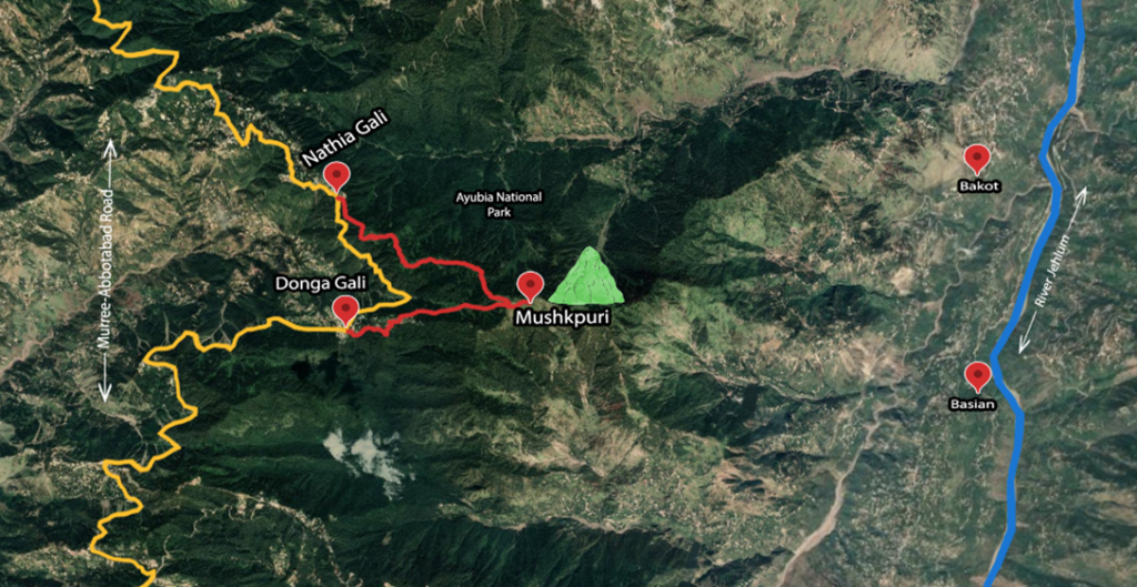
Hike to Mushkpuri
It is a pine covered scenic mountain at 9200 feet or 2800 meters that sits at 2.5 kilometers from Dunga Gali and nearly 4 kilometers from Nathiagali. The hike entails a gradual climb that can be attempted by families and large groups. The Mushkpuri Top is an extended grassy patch that offers numerous picnic spots and great views of the Kashmir mountains. River Jhelum snakes alongside and it can be viewed from the Top.
It is an easy-going hike that takes 1.5 to 2 hours from Dunga Gali and 3 hours or more from Nathiagali. Tour operators offer a day trip to Mushkpuri from Islamabad during summers and winters. For the latter, one must wear the matching gear and carry trekking sticks. It should be reached during the daylight and the summer months offer spectacular views.
Both mountains offer excellent locations for paragliding. Mushkpuri is suited for horse riding. Both hikes can be attempted by large groups. They can be of adventure cum education values for students to promote environmentally friendly eco-tourism. Eco-friendly camping spaces should also be created for overnight stays. However, one is pained to see waste strewn along the trek routes. There is a need to promote awareness and take measures to curb such ecologically harmful activities.