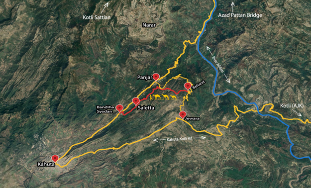
Mountains rising east of Kahuta in Rawalpindi District enclose lush green valleys dissected by water channels. These are sub-Himalayan varieties that receive above sixty percent of rain during the summer monsoons. Kahuta and Kotli Sattian are located at heights ranging between 3000 to 6000 feet above sea level and the region falls within Murree-Kotli Sattian-Kahuta National Park (MKSKNP). Its climate ranges between sub-tropical and the cooler variations at higher altitudes. Two rivers traverse the Park; Jhelum that constitutes the boundary with Kashmir lying eastwards, and Soan that feeds the Simly Dam and drains into the Indus.
| Behand the start point for the Hike. |
The imposing Panjpeer Rocks overlook the Panjar Valley (astride the road Kahuta-Panjar-Azad Pattan) from the north and another set of mountains rise southwards. An under-construction Tourism Highway is being developed in recognition of natural allure of the region. Easily accessible, MKSKNP offers nature endowed pleasing sights and respite during summers at higher altitudes. Chir pine forests survive on the mountains but with a reduced tree cover. The local wildlife that includes leopards and barking deer is close to extinction due to lost habitats and excessive human incursion.
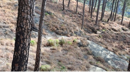
A camel track was laid south of Punjar Valley. As per locals it was created during 1914-15 by the Forest Department for transporting goods and for monitoring purposes. It is wide and even enough for the passage of camels and other animals of burden. It is not in use, but its solid base exists. After having recently done the exacting trek to Panjpeer Rocks, our local friends Brigadier ® Javed Satti and his trekking enthusiast younger brother Air Commodore ® Tufail were very kind to coordinate for us to hike along the scenic Camel Track. Myself, Asad and Tufail hurriedly planned it with a fast diminishing winter footprint.
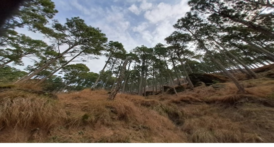
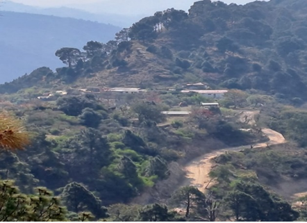
We left Islamabad early on 12 March to reach the start point in the village Behand which is perched in the mountains. A newly constructed scenic mountain road now links it with Punjar. We kicked off after a hearty breakfast at Brig ® Javed Satti’s mountain top residence. The first leg of the hike spanned nearly 5 kilometers along the ridge line. This route is less frequented and is eroded at places dues to slides. It has a dense pine cover which made our going easy in the morning sun. The route follows the mountain contours with its twists and turns. The Jewera Valley with its dotted huts was towards our south. We were told that the pine saplings rarely survive the summer fires which cap the forest’ renewal. This is a source of concern as climate change instigated heat waves cause much damage to the forests and their ecosystems.
The second leg of the hike is again along the ridgeline that overlooks the Kahuta – Azad Pattan Road to our right (or north). It has higher mountains to our south to depict a different setting. The Track is wider and frequented. At places it resembled the famous Nathiagali Pipeline track. It was a very pleasant hike at 2.5 hours travel time from Islamabad. Nature was at its best as the cloud cover made our going breezy and pleasant amid pines, freshwater springs, berries, and occasional huts. This area is saved so far from unplanned development. The hike concluded at a village Siletha on the ridgeline, and it is linked to the Kahuta road below via a jeepable track. We did close to 12 kilometers in over three hours.
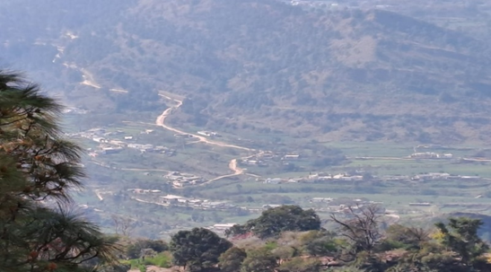
Jewra Valley lies to the south
Conclusions: drawing from our trekking cum hiking experiences the area bounded by Kotli Sattian, Panjpeer Rocks, Punjar, Behand and River Jhelum in the east is best suited for adventure activities preferably during the winter months. Coming to the Camel Track, it is a recommended hiking destination for all age groups, and the school children. There are no challenging inclines, and it offers a multi activity venue like camping, hiking, mountain biking and horse riding along the second segment of the Hike. It is an unpolluted environment with dense pine cover. The area is considered safe, but such activities must be coordinated with the local resource person(s) to secure guidance and support.