

Nathiagali was developed as a summer hill station during the British era. It is located at 8000 feet above sea level; and is equidistant from both Murree and Abbottabad, i.e, 32 kilometers. The pine covered mountainous region is known as ‘galiaat, and its spine forms the watershed between Jhelum catchment towards the east and the Indus catchment sloping westwards. Miranjani is the highest mountain in Nathiagali and it overlooks the majestic Governor’s House from 9816 feet.

Miranjani Top |
Thandiani, on the other hand, is located at a height of 9075 feet southeast of Abbottabad with the TV tower on the skyline. It has grown into a somewhat ill planned mini hill station with some PTDC pods deployed by the KP Tourism Department whose booking is controlled from Peshawar. It is certainly not a tourist friendly arrangement.
| Miranjani, Nathiagali |
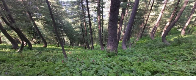
The region houses temperate coniferous and broad leaf forests with deodar, silver fir, oaks, blue pine, and horse chestnuts among the tree varieties. Its plants carry medicinal and insect repellant properties. It is home to a
variety of mammals, mountain leopards, reptiles, monkeys, and beautiful birds. Ayubia National Park was created to conserve its rich flora and fauna.
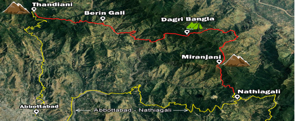
From Islamabad these locations are easily reachable. Over the years, trek to Miranjani was a yearly event. With an early kick off it is an enjoyable trek and on a clear day one can see the outskirts of Havelian, some say even up to Nanga Parbat and the snow-covered Pir Punjal Range in Kashmir. We came across trekkers headed for Thandiani, Abbottabad and thought it was worth a try.
We decided to commence the trek from Thandiani as it would allow us to conclude it in Nathiagali
the following day. I was accompanied by Amin and Adnan. We left early on 21 August 2021 for Thandiani
and teamed up with Shafique (03117889248), our guide-cum-porter, his friend and two horses to carry the
camping gear, food, and water.
The initial part of the trek was a gradual descent along a picturesque pine covered ridge side. After about four hours we reached a village Biran Gali where we took a short break and bought some supplies. We got a beautiful view of the Thandiani ridge.
We then trekked through a relatively dense jungle that afforded good shade. The time of the year was perfect for wildflowers to bloom in hues of purple, pink, yellow in and some other catchy colours. From occasional groves we started to wade through dense flower growths. It was a breathtaking sight; something we had not seen before. Bees accompanied us but we were saved from their stings. Their cross-pollination function is critical to sustaining life.
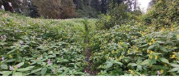
Wild Flowers
We ascended on to a ridgeline from where the Jhelum Valley and the Kashmir mountains were visible. By evening, we reached Dagri Bungla (Forest Department Rest House) located at 8900 feet. On its entrance a plaque states that Thandiani is 16 miles and
Nathiahgali 12. We had traversed 26 kilometers with another 20 to go. We camped the Rest House where some other trekkers were busy settling down. It was partially destroyed during the 2005 earthquake and is in disuse ever since. Water was fetched from a distance, we deployed our tents, had a nan- omelet dinner and settled down for the night.
It took us nearly three hours to trek up to the Miranjani Top the next morning. This stretch entailed a climb though less steep compared to approaching it from Nathiagali due to greater relative height difference. A well-earned break and costly tea from a chaiwala perched at the Top was
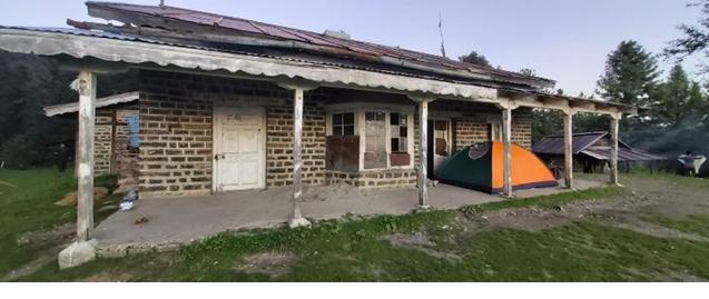
Dagri Bungla
followed by a picture session. Approaching clouds prompted us to descend towards Nathiagali. We came across numerous weekend hikers heading for the Miranjani Top; some excited while others labored their way up. We headed back to Islamabad in the afternoon. So, what do we conclude? This is a beginner’s trek which is easily approachable, and you follow a defined route. Depending upon the time available and the fitness level one can do it in a day and a half as we did it. Or extend it over three days with overnights at Berin Gali and Dagri Bangla. We met trekkers who came from Nathiagali to Dagri Bungla and returned, and those who went ahead but they cut it short by exiting from Berin Gali (onwards to Abbottabad). So, one can avail any of these trekking options.
The trek must be attempted as a group and during daytime as one traverses heavily forested tracts with minimal habitation. A local guide should be hired and carry extra water as most water sources are at a distance
From the route. One can self-plan the trek as we did. KP government, on the other hand, should facilitate the trekkers by developing camping spaces with access to water and toilets at Thandiani and Nathiagali. It must also undertake repair of the Dagri Bungla Rest House.
Was the trek worth the effort? Yes, it was as for most part it took us through a forest stretch that is relatively less disturbed by human intrusion and, thus, it retains a pristine quality. The monsoon rains had endowed nature with deeper hues and the eye-catching flowers served as the proverbial icing on a cake. It was like experiencing nature at its very best. On the downside, the forest tracts closer to Thandiani and Nathiagali bore signs of extensive deforestation which must be checked.
Do such trekking experiences promote eco-tourism? Yes, they do with challenging treks in an exotic natural setting with its alluring flora and fauna. They create an awareness of what nature offers in its diversity. Foremost such treks carry an educational value in experiencing the natural environment first-hand which implores you to preserve it. To leave it undisturbed
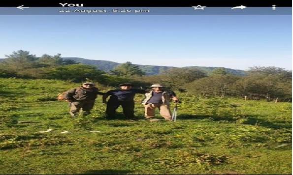
| Amin, Adnan & Kamran (L to R) |
The trek poses moderate degree of difficulty in terms of access, planning and execution. However, it requires camping enroute. It cost us approximately Rs 10,000 per head that covered the cost of guides, portering and food.